One of my routine walks is out across the dam a bit, then back. Yeah, I know, wimpy but fun.
My question is, is the gravel road that runs across the dam and then goes to Indian Bridge road private property? A county road?
I want to walk out to Indian Bridge, but not if I'm trespassing.
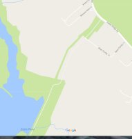
Attached pix shows the Google version of the park boundaries.
This implies the road is not part of the park until you get to the end where there is a parking area and a gate I believe.
I have not been able to find a trail off the main loop trail that would run down the green 'swath' to the west of the road.
Park maps on the DNR website don't show the any part of the lake park connecting to Indian Bridge.
Anybody have information on this?
My question is, is the gravel road that runs across the dam and then goes to Indian Bridge road private property? A county road?
I want to walk out to Indian Bridge, but not if I'm trespassing.
Attached pix shows the Google version of the park boundaries.

This implies the road is not part of the park until you get to the end where there is a parking area and a gate I believe.
I have not been able to find a trail off the main loop trail that would run down the green 'swath' to the west of the road.
Park maps on the DNR website don't show the any part of the lake park connecting to Indian Bridge.
Anybody have information on this?
