nasa
-

Satellite View
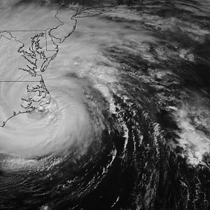
From NASA: Although she had subsided from a Category 5 to a Category 2 storm, Hurricane Isabel still packed considerable punch as she came ashore between Cape Lookout and Cape Hatteras on North Carolina’s Outer Banks on September 18, 2003. Isabel grew to a massive size just before she hit...- Editor
- Media item
- nasa
- Comments: 0
- Album: Hurricane Isabel, September 2003
- Category: Disasters: Natural & Man-made
-

The Eye of Isabel
An excellent photo from NASA showing the eye of Hurricane Isabel as seen from space.- Editor
- Media item
- nasa
- Comments: 0
- Album: Hurricane Isabel, September 2003
- Category: Disasters: Natural & Man-made
-

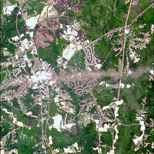
Tornado Swath that devastated La Plata
NASA Satellite Zooms in on Tornado Swath that devastated La Plata, MD.. A number of severe thunder storms swept through the mid-Atlantic states on April 28, bringing high winds, hailstones, and heavy rains to many areas. The intense storms spawned at least two tornadoes, one of which was...- Editor
- Media item
- la nasa plata tornado
- Comments: 0
- Album: Southern Maryland from Space
- Category: Misc. So. Md. Photos
-

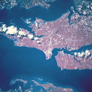
Patuxent Naval Air Station Oct-1994
Patuxent Naval Air Station, Maryland, U.S.A. October 1994. The forested, gently rolling region of southeastern Maryland is visible in this color-infrared, south-southwest-looking, low-oblique view. The runways of the Patuxent Naval Air Center are visible near the center of the image. The Air...- Editor
- Media item
- nasa paxrvr
- Comments: 0
- Album: Southern Maryland from Space
- Category: Misc. So. Md. Photos
-

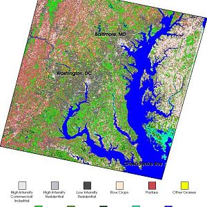
05-chesapeake lcc
Landsat 7 land cover maps to benefit Chesapeake Bay watershed. “Smarter” land use planning and better estimates of polluted water runoff across the 64,000 square-mile (110,000-square-kilometer) Chesapeake Bay watershed are on the horizon thanks to new land cover maps being produced by the...- Editor
- Media item
- bay chesapeake nasa
- Comments: 0
- Album: Southern Maryland from Space
- Category: Misc. So. Md. Photos
