2018 Saw Slight Decline, But Less Severe Than Expected

Baywide, about 91,559 acres of underwater grasses were mapped in 2018. However, more than 20% of the region was not fully mapped in 2018 because of highly turbid water, weather, and security restrictions near military facilities — meaning the actual acreage could be significantly higher.
In 2017, a record-breaking 62,357 acres were recorded in Maryland, and about 105,000 acres were recorded baywide. Since 2012, Maryland has seen a net gain of more than 25,500 acres of underwater grasses and has achieved 63% of the state’s 2025 restoration goal.
Except for the upper Western Shore, the record rainfall throughout 2018 led to higher levels of nutrients and sediments and poorer water clarity in many of Maryland’s waterways. The prolonged muddy waters caused by these nutrients and sediments led to substantial declines in underwater grasses throughout large portions of the Potomac and Patuxent rivers. However, grasses expanded in the Bush, Patapsco, and Magothy rivers where nutrient and sediment inputs were not as excessive.
“The resilience of Maryland’s underwater grasses shows that our commitment to improving the health of the Chesapeake Bay is working and with continued efforts, we are well on our way to achieving our 2025 goal of 79,800 acres,” Maryland Department of Natural Resources Secretary Jeannie Haddaway-Riccio said.
Despite the slight decline in statewide underwater grass abundance, all or part of eight Maryland rivers surpassed their restoration goals. These included the Northeast River at 105%; the Chesapeake and Delaware Canal at 236%; the tidal fresh portion of the Chester River at 47,057% (the percentage of the goal attained is so high due to a very small segment restoration goal); the middle Chester River at 282%; the western branch of the Patuxent River at 146%; the upper Gunpowder River at 157%; the Bush River at 104%; the upper portion of the Big Annemessex River at 161%; and Fishing Bay at 102%. An additional four river segments in Maryland reached 75% or more of their restoration goals.
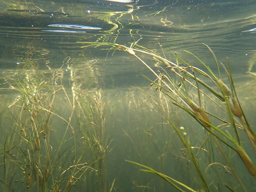
Underwater grasses respond quickly to improvements in water quality conditions, making them a critical indicator of restoration progress. Less nutrient and sediment pollution leads to improved water clarity, which in turn, allows for increased underwater grass growth. Also known as submerged aquatic vegetation (SAV), underwater grasses are a critically important bay habitat that removes nutrients and sediment from the water column, reduce shoreline erosion, provide nursery habitat and protection for species like the blue crab and largemouth bass, and support and sustain migrating waterfowl.
“Last summer’s record rainfall – and the accompanying runoff and turbidity – put stress on our underwater grasses, but the previous five years of expansion helped the vast majority of the grass beds survive,” said Maryland Natural Resources biologist Brooke Landry, who chairs the SAV workgroup for the Chesapeake Bay Program.
The lower Eastern Shore received significantly less rainfall compared to other regions of the state and water clarity was within range of previous years. As a result, the lower Eastern Shore tributaries, including the Big Annemessex, Manokin, and lower Pocomoke rivers and Tangier Sound, saw increased underwater grass abundance in 2018.
The annual aerial survey was conducted by the Virginia Institute of Marine Science between May and October 2018 and covered 111 flight lines. The aerial imagery is used to identify the amount and location of underwater grasses in the Chesapeake Bay and tidal tributaries.
Additional aerial and satellite imagery was used to augment the imagery in portions of the Bay that could not be mapped.
